
When planning international shipments, it is worth thoroughly considering which route is best suited for your destinations, delivery budget, deadlines, and agreements with other parties to the logistics process.
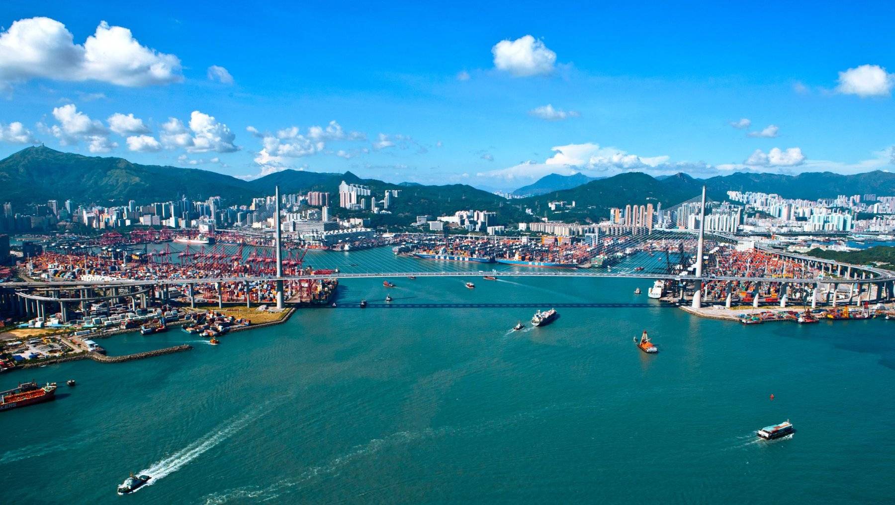
Shipping routes are of primary importance, as they differ in traffic density and congestion. It is necessary to understand which of them are “maritime highways” and which are used less in trade and logistics operations. Some of the world's most significant routes, like the Suez Canal and the Strait of Hormuz, account for a substantial percentage of global oil and cargo traffic, emphasizing their importance in the broader logistics and trade landscape.
What is the maritime shipping route?
There are naturally or artificially created shipping routes (or sea lanes). The purpose of using them is to achieve the shortest and safest way to carry out the delivery. Shipping routes connect the hub port and transshipment points along river or sea routes. The high density of commercial shipping in the world's oceans illustrates the proven efficiency of modern port infrastructure and shipping route planning.
Below is an overview of the most popular and, accordingly, busiest sea routes in the world.
What are the main maritime routes?
No. 1: The Panama Canal
- A human-created canal that joins Asia with the eastern seaboard of the United States.
- Each year, around 14,000 vessels make use of a direct route as they journey between the Atlantic and Pacific Oceans.
No. 2: The Suez Canal
- An important sea route with about 19,000 vessels passing through it every day.
- The shortest trade route for European and Asian countries crosses the Red Sea.
- Account for 12% of global trade and comprise 30% of the shipping containers carrying goods worldwide.
- From Asia and the Middle East to Europe, the Canal transports 7-8% of the world's oil and hydrocarbons and 8% of liquefied natural gas.
No. 3: The English Channel or Dover Strait
- This is one of the busiest sea routes globally, with about 500 to 600 ships traveling through it every day.
- This is an important trade route that connects European countries and the UK. It connects the North Sea to the Atlantic Ocean.
- Transporting nearly a quarter of goods brought into the UK from the European Union and nearly a third of goods sent from Great Britain to the European Union.
No. 4: The Strait of Malacca
- The shortest trade route between the Pacific and Indian Oceans.
- The Strait connects major Asian economies: Japan, Malaysia, Singapore, Indonesia, India, and China.
- The annual turnover of vessels is more than 83,000.
No. 5: The St. Lawrence Seaway
- The quickest route for trading links the United States to the northern parts of Canada.
- Every year, about 50 tons of goods are transported.
No. 6: The Strait of Hormuz
- The shipping lane connects the Gulf of Oman with the Persian Gulf to transport oil more quickly.
- The Strait is very important for Asian countries like South Korea, Singapore, India, China, and Japan to grow their economies.
However, you can fully prepare for the congestion and high tariffs on popular sea routes. This guide will show you how to avoid high budget costs when planning your transportation. According to the requirements of the vehicle, the SeaRates team will offer you the lowest freight rate, or you can find all the rates yourself and compare the best ones through the SeaRates seamless Logistics Explorer tool.
What is the volume of cargo and commodities transported on the main shipping routes?
How many ships move around the world? This number is increasing every year and now stands at around 60,000 vessels. Each vessel carries millions of containers and bulk cargo. In total, this is more than 11 billion tons of cargo per year on the world's busiest shipping lanes.
Many types of goods are transported by cargo vessels, as most of the world’s industries carry out trade and logistics operations on a daily basis, such as:
- Metallurgical factories with specialized equipment and bulky cargo
- Agriculture and grocery sectors
- Oil and mineral fertilizer industry
- Information technology businesses
- Raw material suppliers
- Pharmaceutical companies
- Chemical manufacturers
- Car component suppliers and large consignments of vehicles
How can digital solutions help improve cargo management?
The congestion of the world's oceans is prompting port authorities, freight forwarders, consignees, and other logistics parties to consider solutions to traffic congestion, a lack of equipment, space for shipments, and, in general, a sharp surge in traffic along most sea lanes.
Using extensive data from global shipping companies and its own unique experience in managing shipping networks, SeaRates delivers effective supply chain solutions.
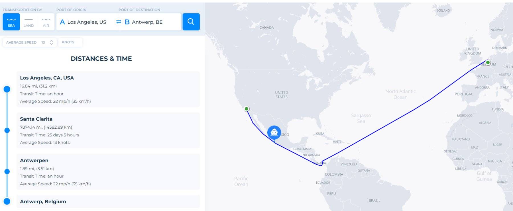
It is necessary to research the information on the required routes in the easiest way possible. Only by entering 2 points in Distance & Time tool, you find the best route for your deliveries, transit time for each one, shipping deadlines, and other important details for specific world shipping routes.
Conclusion
Without paying sufficient attention to logistics management operations, you face serious risks on any shipping route, such as delays and congestion inside ports or on sea routes, a lack of containers or an excess of empty ones in different directions, and more.
These difficulties can be easily avoided with the help of logistics solutions for cargo management and innovative IT tools for shipping; freight forwarders, consignees, and other parties to logistics operations can easily find the best distances and transit times for planning shipments, predict the ETA and ATA, get the cheapest freight rates for any destination, instantly book them, help you with the container cargo tracking process, and much more.
Contact us at [email protected] to find out more about SeaRates tools to simplify your logistics operations.