Cargo calculator
-
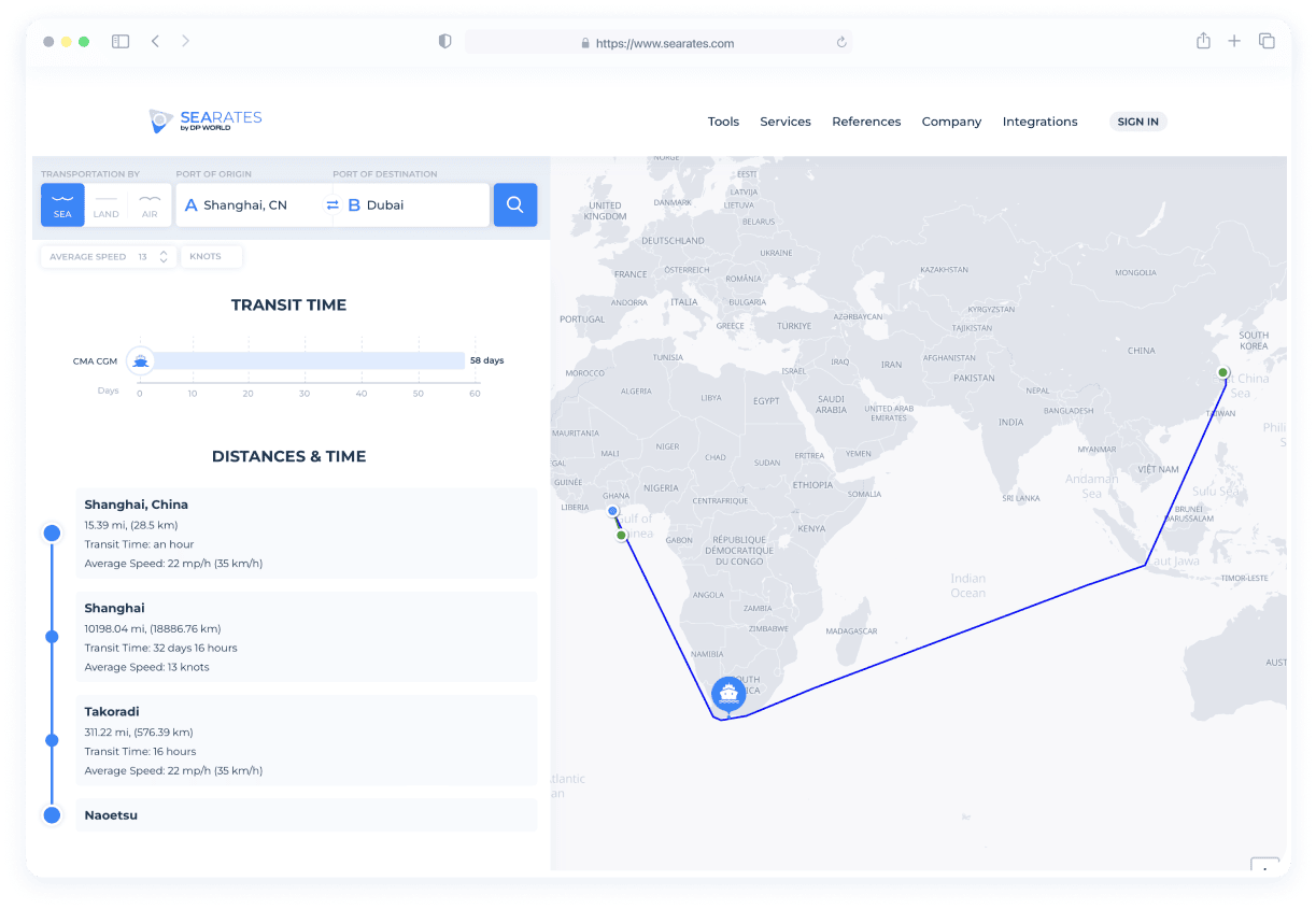
What’s Distance & Time?
It’s a logistics application created to estimate distances and times between sea routes under particular parameters.
-
How it works?
You insert your origin and destination and then the system displays data about distances and time estimates from SeaRates database.
-
What’s the information based on?
Open sources combined with information from various shipping lines and nautical agencies. This information has been collected for over ten years and is regularly updated.
Get your planning under control
Few professional shipping companies are able to answer this question “When will I get my shipment?” to the client’s satisfaction. Our transit time system lets you fill this gap in seconds The clean interface is visually appealing and easy to use. Keeping track of your delivery time is important if you want to provide clients with accurate estimates after order placement. This is what we’ve been doing at SeaRates for many years and are now sharing with the rest of the world!
Distance & Time made simple
Often customers are given a very rough estimate of their delivery. “It will take two to four weeks”, for example, or “it can be delivered by Friday if you place your order in the next 12 hours”. This gives a frame of reference to the customer, but all other things being equal, given a choice between several companies with similar prices, the customer will choose the one with the fastest delivery service. So precise information is always preferred, since it is often necessary to prepare or be personally present for the delivery. Not to mention that properly timing your delivery is crucial to avoid work gaps in production. Save yourself some unwanted trouble by installing our Distance & Times tool to help you compete in the marketplace!
Usually the transport companies integrate the app with Logistics Explorer to also provide customers with instant shipping rates from/to anywhere in the world. It can also be enhanced by Route Planner to also schedule shipments easier and track sea lines
Distance & Time
Make your site better by integrating tools from SeaRates
Shipping Distance & Time Calculator
Distance & Time is web application, which allows to calculate distances and transit time between two points using different modes of transport.