

Earlier this week, the SeaRates team announced the release of a new Logistics Map tool. The functionality is filled with detailed data on all shipping requests created on SeaRates.com. This innovative solution provides you with access to requests, helping you promote your logistics services for sea, air, and land transportation in one place. Which advantages does the Logistics Map tool have?
How does it work: for Freight Forwarders and Carriers
The comprehensive functionality of the Logistics Map tool benefits the logistics and trade businesses of freight forwarders, airlines, and transport operators with accurate data from a multitude of transportation requests from shippers around the world.
The tool's user-friendly interface provides an accessible geographical location of cargo around the world. Therefore, currently, you have access to the Cargo tab's capabilities:
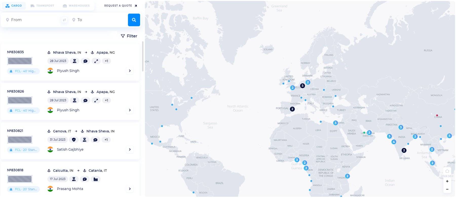
If you need to receive more orders for a specific destination, enter the departure and arrival points. Along this route, you will find all the freight requisitions.
For example, if you have the best freight rates for a destination from Norway to the UK, with Logistics Map, you can also select this destination to pick up several orders from shippers who are interested in such transportation. So, you deploy a full vessel of containers with cargo at the best rates for shippers.
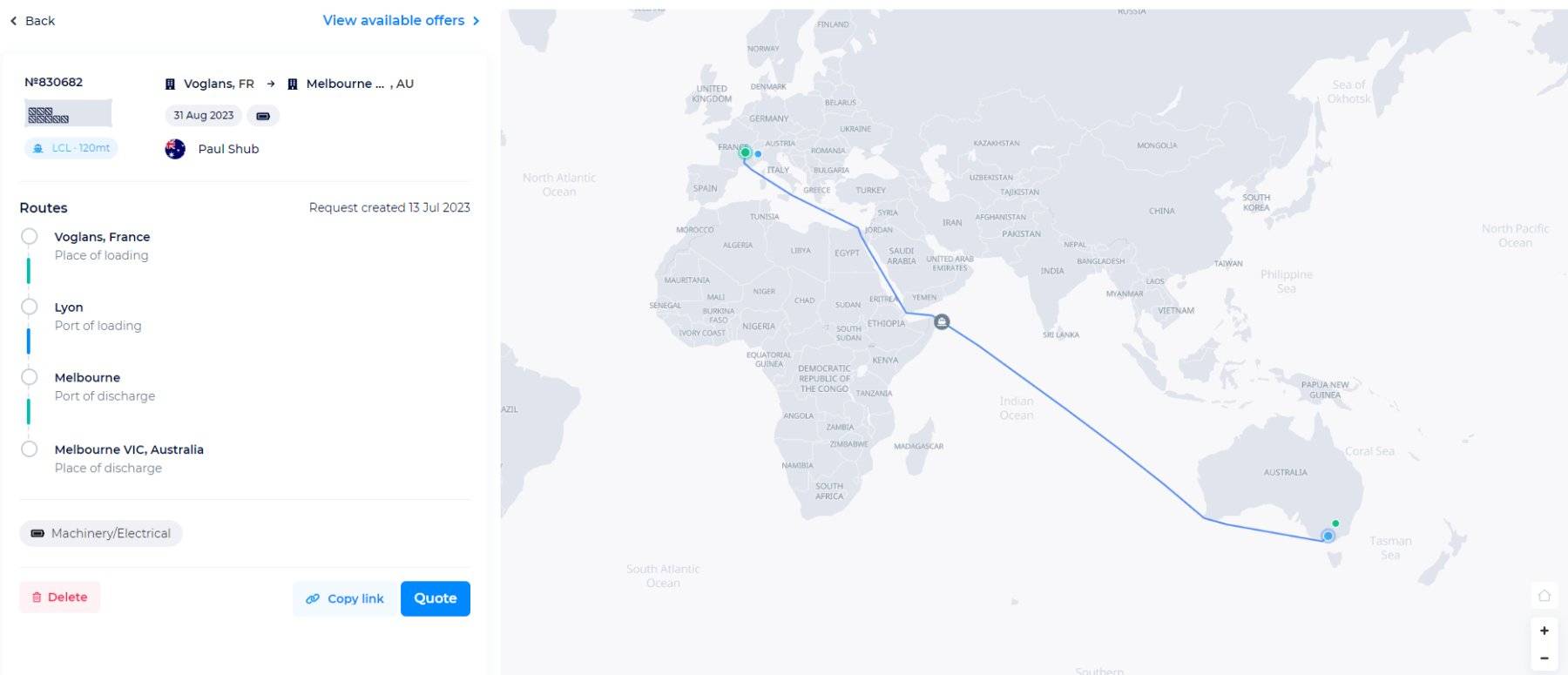
Similarly, if you already have an order from Voglans, France, to the port of Melbourne, you can complete it with another order for this route by offering your services.
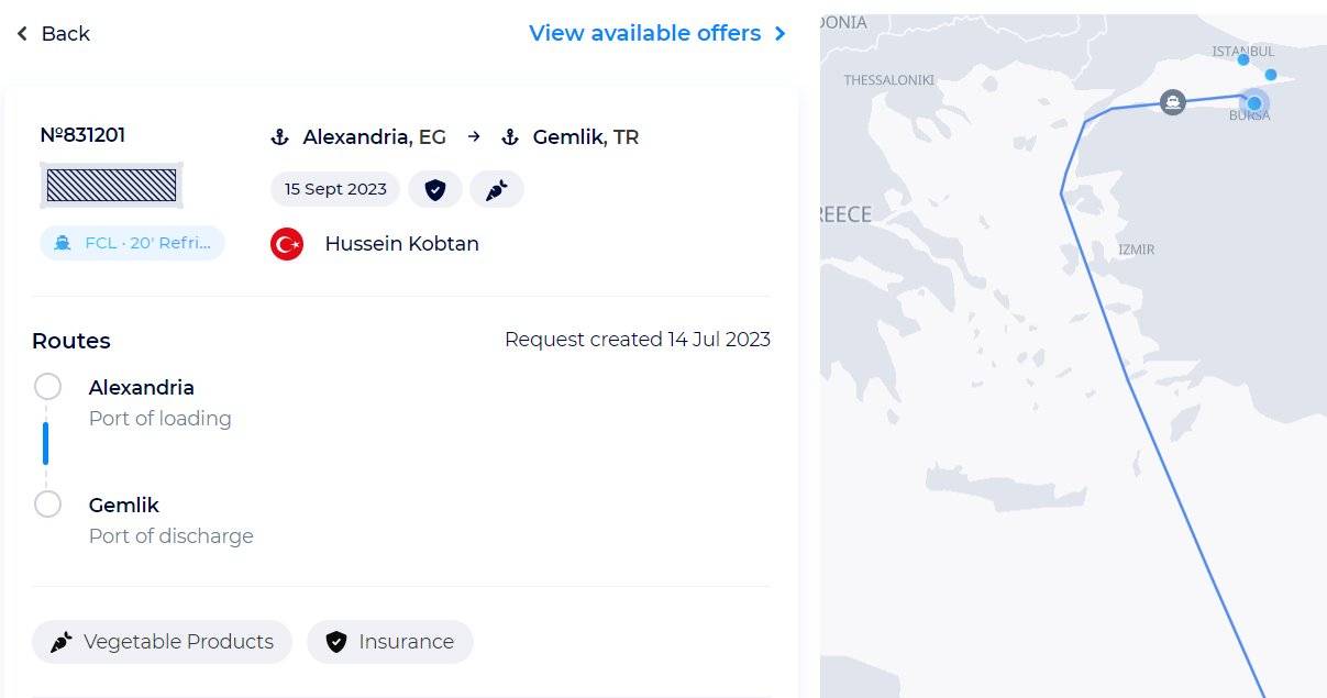
You can immediately view the details of the order, including the date the request was created, whether is it ready to load, and the type of cargo. Also, you have access to the module on the best route for this transportation on the world map.
Then, you can Copy link to contact our support team via chat with an offer of your services for this shipper’s shipping request.
Expand the potential geography of your shipping services
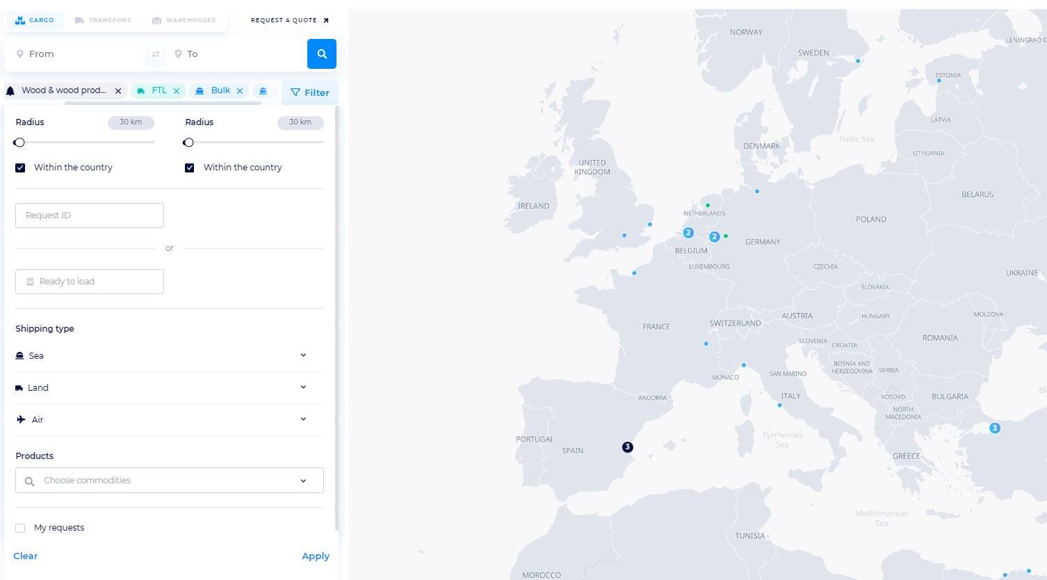
You can also view the full list of requests for transportation to all possible destinations and filter them by radius, Request ID, or Ready to load, and product types. Next, select a shipping type and apply filters:
- by sea (FCL, LCL, Bulk)
- by land (FWL, FTL, FCL, LTL)
- by air (Standard cargo, ULD Container)
Thus, you get an accurate visualization of precisely where the cargo is located for transportation around the world. By clicking on the numbers, you see more cargoes.
You can select a request from the list on the left, or click on a cargo on the map to get detailed information about the request and its route.
After that, you can also create an individual request or contact the SeaRates team to provide your own tariffs for shippers.
Shipping lines, transport operators, airlines, etc.—any logistics provider can offer their transportation services by quickly searching for a potentially interested shipper. Freight forwarders, carriers, and DF Alliance members can use the Logistics Map tool to provide their beneficial freight rates by finding requests from real shippers in the most convenient and fastest way.
How does it work: for Shippers
When making a request for transportation, you, as a shipper, specify from and to where you need to deliver your cargo, by which types of transport, and other shipping details. Your request will be displayed in the Logistics Map tool.
To quickly create your request, you can click on the "Request a Quote" tab to go to the form of an individual quote for your cargo shipment.
The "View available offers" function will direct you to the Logistics Explorer tool to instantly get a freight rate for the route, or to the Quick Request form:
After having provided all the details of the transportation you are planning to carry out, you receive quotes from trustworthy carriers directly, or our team will offer you a tariff according to your requirements.
Take advantage of Logistics Map's additional features by copying your request and sending it to a SeaRates manager to provide shipping data. Thus, you can track the status of your request in Virtual Office. You can also view freight rates for all routes on your requests in Logistics Explorer.
Upcoming updates of the Logistics Map tool
Logistics Map improvement: Transport tab
The Logistics Map will include an option to locate and find transport under the Transport tab.
Carriers and freight forwarders, including DF Alliance members, will be able to add trucks, railroad cars, vessels, and airplanes (including charter flights) for shippers.
For example, a freight forwarder adds a truck, indicating where it is located and what directions and routes it provides transportation. Customers can easily find vehicle locations, select the best option based on carrier prices, and submit shipping requests.
Logistics Map will provide an opportunity to expand logistics services by offering transport positions and satisfying customers with faster shipping solutions.
Logistics Map improvement: Warehouses tab
The functionality of the Warehouses tab is planned for the Logistics Map tool. This is a useful opportunity for logistics companies that own or rent warehouses to provide warehousing services to place them on the tool map and provide a list of warehousing services. This way, it is easier for shippers to find your warehouse through requests for warehouse services or through the Cargoes tab and send a request.
Conclusion
Convenient visualization and global search of the assets available on the modern logistics market are provided in one place – in the Logistics Map tool.
Each version and a new feature allow shippers, carriers, freight forwarders, and other logistics providers to quickly find and promote sea, air, and land shipping services.
Reach out to us at [email protected] for assistance with any of your logistics needs.